
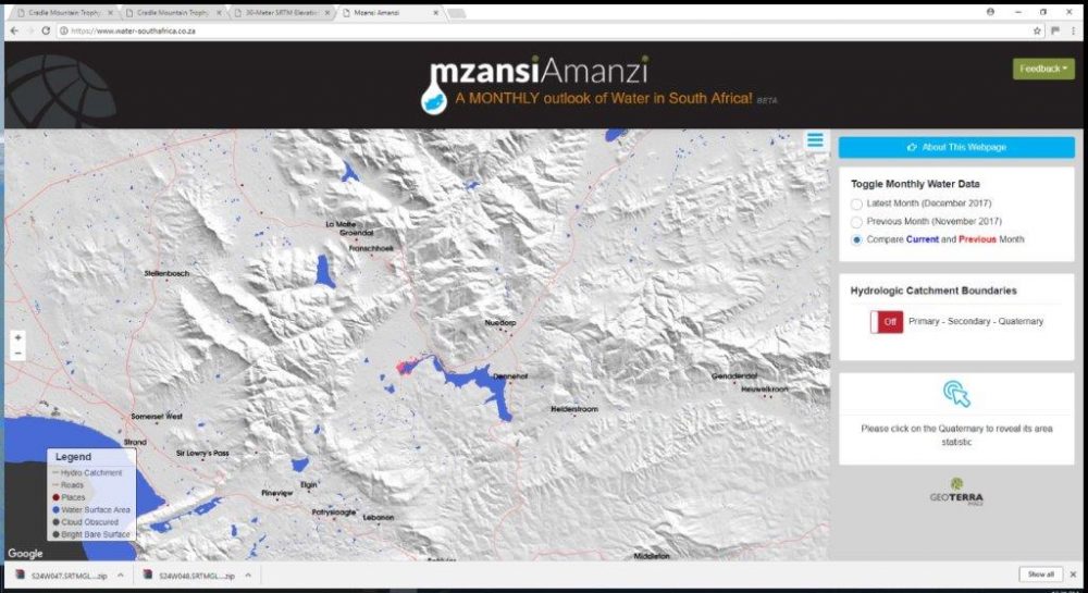

Water- South Africa- Insights into the Western Cape drought by GEOTERRAIMAGE
GEOTERRAImage’s latest initiative with regards to the monitoring of surface water resources across South Africa.
With the Western Cape really feeling the pressure of the drought, we are confident that we’ll be able to contribute positively towards understanding and monitoring their surface water.
Water South Africa- our monthly water monitoring service, allows us to determine the surface water extent in our entire country, with use satellite imagery. Being able to accurately and repeatedly monitor available water resources across the entire landscape is a key information requirement for successful water resource management.
Attached video loop shows the significant changes in surface water extent of Theewaterskloof Dam (Western Cape) over the last 6 months, as mapped from ESA Sentinel Satellites.
This information has been extracted our public service website to help monitor water resources across South Africa. The website can be found at the following address https://www.water-southafrica.co.za.
CLICK HERE to submit your press release to MyPR.co.za.
Track Your Press Release HERE:
Check Online Visibility
Verify where this release is currently indexed:
 2018 Toyota Warrior OCR Series Off To a Flying Start